


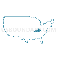
FIVCO Area Development District PUMA, Kentucky
About
Outline

Summary
| Unique Area Identifier | 192986 |
| Name | FIVCO Area Development District PUMA |
| State | Kentucky |
| Area (square miles) | 1,583.98 |
| Land Area (square miles) | 1,563.67 |
| Water Area (square miles) | 20.32 |
| % of Land Area | 98.72 |
| % of Water Area | 1.28 |
| Latitude of the Internal Point | 38.27551820 |
| Longtitude of the Internal Point | -82.91163580 |
Maps

Graphs
Select a template below for downloading or customizing gragh for FIVCO Area Development District PUMA, Kentucky


Neighbors
Neighoring Public Use Microdata Area (by Name) Neighboring Public Use Microdata Area on the Map
- Big Sandy Area Development District PUMA, KY
- Buffalo Trace & Gateway Area Development Districts PUMA, KY
- Cabell, Wayne & Mason Counties--Huntington City PUMA, WV
- Scioto & Lawrence Counties PUMA, OH
Top 10 Neighboring County (by Population) Neighboring County on the Map
- Scioto County, OH (79,499)
- Lawrence County, OH (62,450)
- Boyd County, KY (49,542)
- Wayne County, WV (42,481)
- Greenup County, KY (36,910)
- Carter County, KY (27,720)
- Johnson County, KY (23,356)
- Rowan County, KY (23,333)
- Lawrence County, KY (15,860)
- Morgan County, KY (13,923)
Top 10 Neighboring County Subdivision (by Population) Neighboring County Subdivision on the Map
- Ashland CCD, Boyd County, KY (27,229)
- Portsmouth city, Scioto County, OH (20,226)
- Morehead CCD, Rowan County, KY (17,938)
- Flatwoods-Russell CCD, Greenup County, KY (16,224)
- Upper township, Lawrence County, OH (15,418)
- Paintsville CCD, Johnson County, KY (14,132)
- Grayson CCD, Carter County, KY (10,738)
- Butler district, Wayne County, WV (10,114)
- Porter township, Scioto County, OH (9,918)
- Ashland South CCD, Boyd County, KY (8,405)
Top 10 Neighboring Place (by Population) Neighboring Place on the Map
- Ashland city, KY (21,684)
- Portsmouth city, OH (20,226)
- Ironton city, OH (11,129)
- Flatwoods city, KY (7,423)
- Wheelersburg CDP, OH (6,437)
- Westwood CDP, KY (4,746)
- Grayson city, KY (4,217)
- South Point village, OH (3,958)
- Russell city, KY (3,380)
- Kenova city, WV (3,216)
Top 10 Neighboring Unified School District (by Population) Neighboring Unified School District on the Map
- Wayne County School District, WV (42,481)
- Carter County School District, KY (27,720)
- Boyd County School District, KY (23,719)
- Rowan County School District, KY (23,333)
- Ashland Independent School District, KY (21,761)
- Portsmouth City School District, OH (21,639)
- Greenup County School District, KY (19,515)
- Johnson County School District, KY (19,495)
- Lawrence County School District, KY (15,860)
- Morgan County School District, KY (13,923)
Top 10 Neighboring State Legislative District Lower Chamber (by Population) Neighboring State Legislative District Lower Chamber on the Map
- State House District 89, OH (120,820)
- State House District 96, KY (41,590)
- State House District 99, KY (41,007)
- State House District 97, KY (40,179)
- State House District 71, KY (38,856)
- State House District 98, KY (38,852)
- State House District 100, KY (37,710)
- State House District 17, WV (34,820)
- State House District 20, WV (17,527)
Top 10 Neighboring State Legislative District Upper Chamber (by Population) Neighboring State Legislative District Upper Chamber on the Map
- State Senate District 14, OH (380,921)
- State Senate District 27, KY (110,935)
- State Senate District 18, KY (106,760)
- State Senate District 31, KY (101,309)
- State Senate District 25, KY (100,866)
- State Senate District 6, WV (93,502)
Top 10 Neighboring 111th Congressional District (by Population) Neighboring 111th Congressional District on the Map
- Congressional District 4, KY (741,464)
- Congressional District 2, OH (673,873)
- Congressional District 5, KY (670,051)
- Congressional District 6, OH (623,742)
- Congressional District 3, WV (588,817)
Top 10 Neighboring Census Tract (by Population) Neighboring Census Tract on the Map
- Census Tract 9502, Martin County, KY (8,073)
- Census Tract 311, Boyd County, KY (7,919)
- Census Tract 9301, Lawrence County, KY (6,953)
- Census Tract 310.02, Boyd County, KY (6,942)
- Census Tract 9606, Carter County, KY (6,401)
- Census Tract 29, Scioto County, OH (6,259)
- Census Tract 204, Wayne County, WV (6,232)
- Census Tract 404, Greenup County, KY (5,956)
- Census Tract 9201, Elliott County, KY (5,688)
- Census Tract 309, Boyd County, KY (5,524)
Top 10 Neighboring 5-Digit ZIP Code Tabulation Area (by Population) Neighboring 5-Digit ZIP Code Tabulation Area on the Map
- 45662, OH (30,219)
- 41102, KY (21,712)
- 45638, OH (21,635)
- 40351, KY (20,329)
- 41101, KY (18,758)
- 41143, KY (14,535)
- 41164, KY (13,125)
- 45680, OH (13,074)
- 45694, OH (12,147)
- 41230, KY (11,730)